GNSS Receivers & Accessories
One rugged device for locating, capturing, and recording the point.
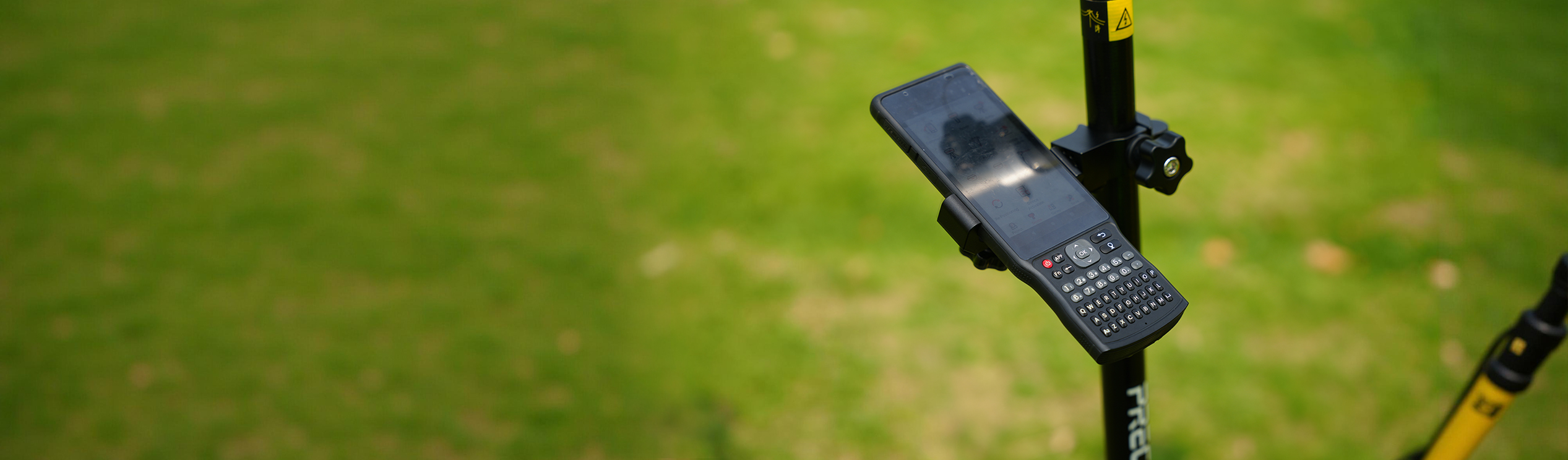
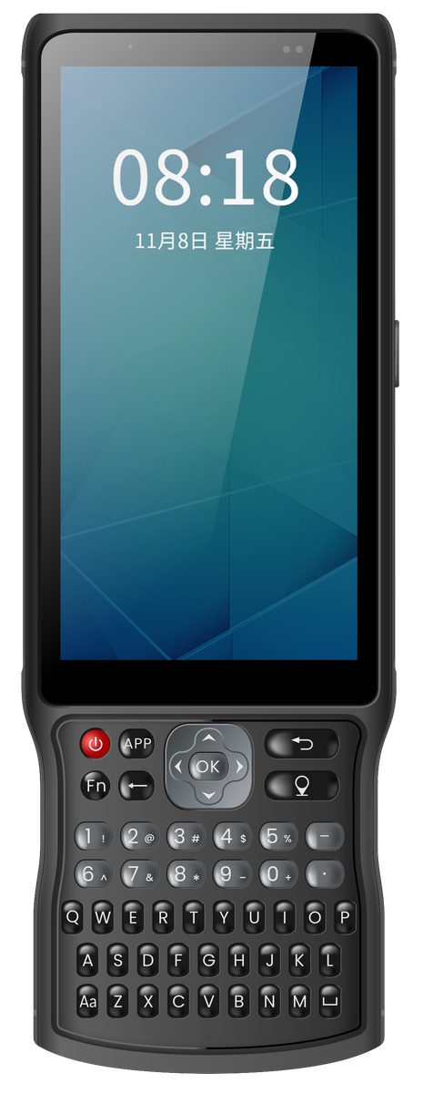
PRECISE PC3: Laser & Image GNSS Receiver. 5.45" high-brightness touchscreen with full physical keyboard | 9000 mAh battery | IP68 | 4G dual-SIM, dual-band Wi-Fi, Bluetooth 5.0
PRECISE PC3 is a Laser & Image GNSS Receiver: a rugged, handheld Android field unit combining satellite positioning with laser-assisted and image-based point measurement. It's a data-collection device, not a standalone survey instrument; for centimeter-level RTK accuracy, it works alongside PRECISE RTK receivers and total stations.
Challenge
Field data collection asks a lot of a single device: it has to survive rain, dust, drops, and long days outdoors; it has to stay connected to receivers, correction services, and office systems; and it has to let you record point data quickly, whether you're tapping a touchscreen or keying in point names and codes with gloves on. A consumer phone or tablet can do some of this, but rarely all of it, and rarely for a full field day without a battery scare.
Solution
PC3 combines satellite positioning with laser and image-assisted point measurement in a rugged Android 11 body. A 5.45" high-brightness touchscreen pairs with a full physical keyboard, so you can switch between touch navigation and fast, reliable text entry, backed by the battery, sealing, and connectivity to keep working through a full field day.
Value
A single field device built around how professional data collection actually happens outdoors, not a repurposed consumer phone.
Key Benefits
Why PC3
Touchscreen Plus Physical Keyboard
Touchscreen and full physical keyboard together
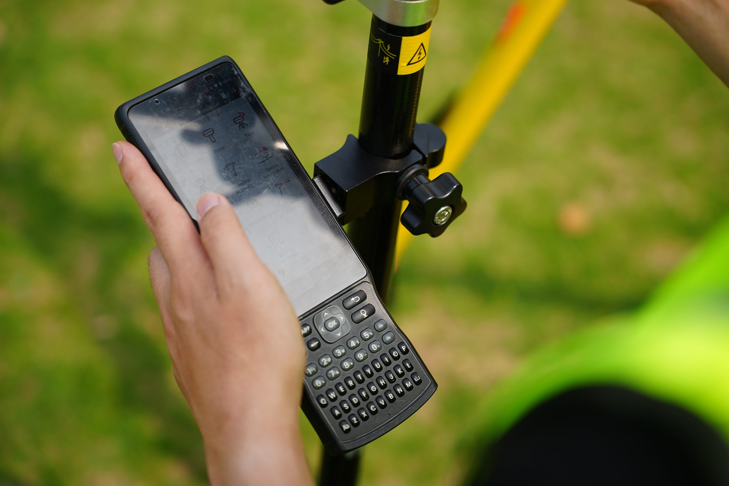
Use touch for maps and navigation, and switch to physical keys for fast, reliable point-name entry, including with gloves on or in wet conditions.
0.00"
Touchscreen Size
720×1440
Display Resolution
5.45" touchscreen (720 × 1440, five-point capacitive) plus a full physical keyboard with directional keys.
Comprehensive Field Connectivity
Comprehensive field connectivity
Connects to network RTK correction services, compatible field equipment, and office systems without being limited to one path.
Dual Nano SIM 4G, 2.4/5 GHz dual-band Wi-Fi, Bluetooth 5.0, and USB-C. NTRIP/CORS subscriptions are arranged separately.
9000 mAh All-Day Battery
9000 mAh battery for a full field day
Reduces mid-day charging interruptions and device swaps during extended outdoor data collection.
0mAh
Battery Capacity
9V/2A
Max Fast-Charging Input
9000 mAh battery with Type-C fast charging (up to 9V/2A); actual runtime varies with usage and conditions.
IP68 Rugged Construction
IP68 rugged construction
Reduces the risk of water, dust, and drop damage interrupting fieldwork on measurement, construction, and agricultural sites.
IP0
Ingress Protection Rating
IP68-rated sealing on an industrial-grade chassis; protection depends on seals and covers being properly closed.
Applications
Where It's Used
Customers
What Our Customers Are Saying
Budi Santoso
Indonesia
“Our crew works construction sites through monsoon season, and the PC3 just keeps going. Dust, mud, sudden downpours, none of it slows us down anymore.”
Diego Fernandez
Mexico
“One charge gets us through a full day of stakeout work without hunting for an outlet halfway through the shift.”
Olena Kovalenko
Ukraine
“Working in freezing conditions with gloves on, the physical keyboard is what makes fast point-code entry possible. A touchscreen alone would be useless out there.”
Thabo Nkosi
South Africa
“PC3 pairs straight to our total station and RTK rover over Bluetooth, one controller instead of switching devices between jobs.”
Resources
Downloads & References
Technical Highlights
Engineered Detail
Laser & Image GNSS Receiver integrated satellite positioning with laser-assisted and image-based point measurement
Touchscreen and full physical keyboard for flexible field input
5.45" high-brightness display, 720 × 1440 resolution, five-point capacitive touch
9000 mAh battery with Type-C fast charging
IP68-rated, industrial-grade rugged construction
4G dual-SIM, dual-band Wi-Fi, Bluetooth 5.0, NFC, and USB-C connectivity
Technical Specifications
Full Spec Sheet
Platform & Display
Connectivity
Power & Physical
How It Works
From Setup to Result
Connect to your measurement equipment
PC3 connects to your GNSS receiver, total station, or other compatible measurement equipment via Bluetooth or another supported interface.
Control the equipment and capture points
Field software running on PC3's Android 11 platform controls the connected equipment, displays coordinates, maps, and project data, and captures point measurements, combining GNSS positioning with laser-assisted and image-based point capture where the workflow calls for it.
Enter point names, codes, and attributes
Point names, codes, and attributes are entered through the touchscreen or the physical keyboard, whichever suits the working conditions.
Store and transfer project data
Project data is stored on-device (64 GB) and transferred or synced via 4G, Wi-Fi, or USB-C as needed.
Keep working through a full day outdoors
The 9000 mAh battery and IP68 housing keep the device running and protected through a full day of outdoor work.
FAQ
Common Questions
It describes PC3's core identity: a handheld GNSS positioning device that integrates laser-assisted and image-based point measurement capabilities in one rugged unit, rather than a general-purpose tablet or phone repurposed for field use. For centimeter-level RTK survey accuracy, PC3 works alongside PRECISE RTK receivers and total stations, which perform the high-precision positioning calculation.
PC3 provides integrated satellite positioning and functions as a laser and image-assisted measurement and field-control device. For centimeter-level RTK results, it is designed to be used together with PRECISE RTK receivers and total stations rather than as a standalone survey-grade positioning instrument.
PC3 uses a 9000 mAh battery with Type-C fast charging. PRECISE does not publish a fixed number of hours because actual runtime depends on screen brightness, network and Bluetooth usage, software load, and temperature. The battery is sized for extended outdoor data-collection use.
PC3 is rated IP68. This provides strong protection against dust and water ingress under tested conditions, but it does not guarantee performance after prolonged submersion, and protection depends on port covers and seals being properly closed and on the unit's condition over time.
PC3 is designed to be compatible with PRECISE RTK receivers and total stations, and connects via Bluetooth, Wi-Fi, 4G, and USB-C depending on the equipment and workflow. Compatibility with specific third-party devices, software, and protocols should be confirmed for your particular setup.
Pre-installed software, licensed modules, and supported device lists depend on the final delivery configuration. Please confirm the specific software package and licensing with your PRECISE sales contact before deployment.
The combination of a capacitive touchscreen and a full physical keyboard is intended to support both conditions: touch for general navigation, and physical keys for reliable text entry when gloves, moisture, or precision typing make touchscreen input less practical.
Get in Touch
Talk to PRECISE About PC3
Tell us about your project and we'll route it to the right PRECISE team.
- Sales: sales@precise-geo.com
- Support: support@precise-geo.com
Put One Rugged Device Between You and the Field, Not Three.
Talk to our team about configuring PC3 for your RTK receiver, total station, and software workflow.