GNSS+IMU Fusion
Position tells you where. Orientation tells you how. PRECISE fuses both.
GNSS alone can't tell you that a survey pole is leaning, that an excavator bucket has just rotated, or that a tractor is tilting on a slope. PRECISE's GNSS+IMU fusion combines satellite position with continuous inertial sensing, so the final output accounts for orientation and motion, not just a single coordinate.
Why Fusion
Neither Sensor Covers the Other's Gap Alone
GNSS Alone
Gives an absolute position fix, but only for wherever the antenna itself is; it says nothing about the orientation of a survey pole, the angle of an excavator's boom and bucket, or the tilt of a tractor chassis on sloped ground. A tilted pole or a rotated implement means the antenna's position is no longer the position you actually need.
IMU Alone
Tracks orientation, rotation, and motion continuously and at high frequency, but has no absolute reference, so its estimate of position drifts over time without something to periodically correct it back to ground truth.
Fusing the two closes both gaps at once: GNSS anchors the overall position to real-world coordinates, and IMU fills in what GNSS can't see (tilt, joint rotation, and orientation) between and alongside every GNSS update. PRECISE applies this same core principle differently depending on what the product needs to solve.
In PRECISE Products
Three Problems, One Fusion Principle
Machine Guidance
PRECISE E2: Dual GNSS + dual IMU for real-time bucket position
E2 uses dual GNSS receivers to fix the excavator's position and heading, and dual IMU sensors to track boom, arm, and bucket angles in real time, including rotations that happen out of the operator's direct line of sight. An onboard computer continuously combines both data streams to calculate the bucket edge's real-world 3D position and compares it against the operator's design target.
Horizontal ±1.5 cm · elevation ±3 cm · bucket dynamic attitude accuracy 0.2° · heading angle 0.15°/R · pitch/roll angle 0.25°/R (R = baseline length of the dual antennas)
Explore PRECISE E2Precision Agriculture
PRECISE A Pro: Attitude sensing for terrain compensation
A Pro combines GNSS/RTK positioning with built-in attitude sensing to hold a tractor to a planned steering line at ±2.5 cm pass-to-pass accuracy. When the attitude sensor detects the tractor tilting or rolling on sloped or uneven terrain, the system adjusts the steering path accordingly, extending reliable auto-steering to ground that would otherwise cause an uncorrected GNSS-only system to drift off-line.
±2.5 cm pass-to-pass accuracy
Explore PRECISE A ProRTK Receiver
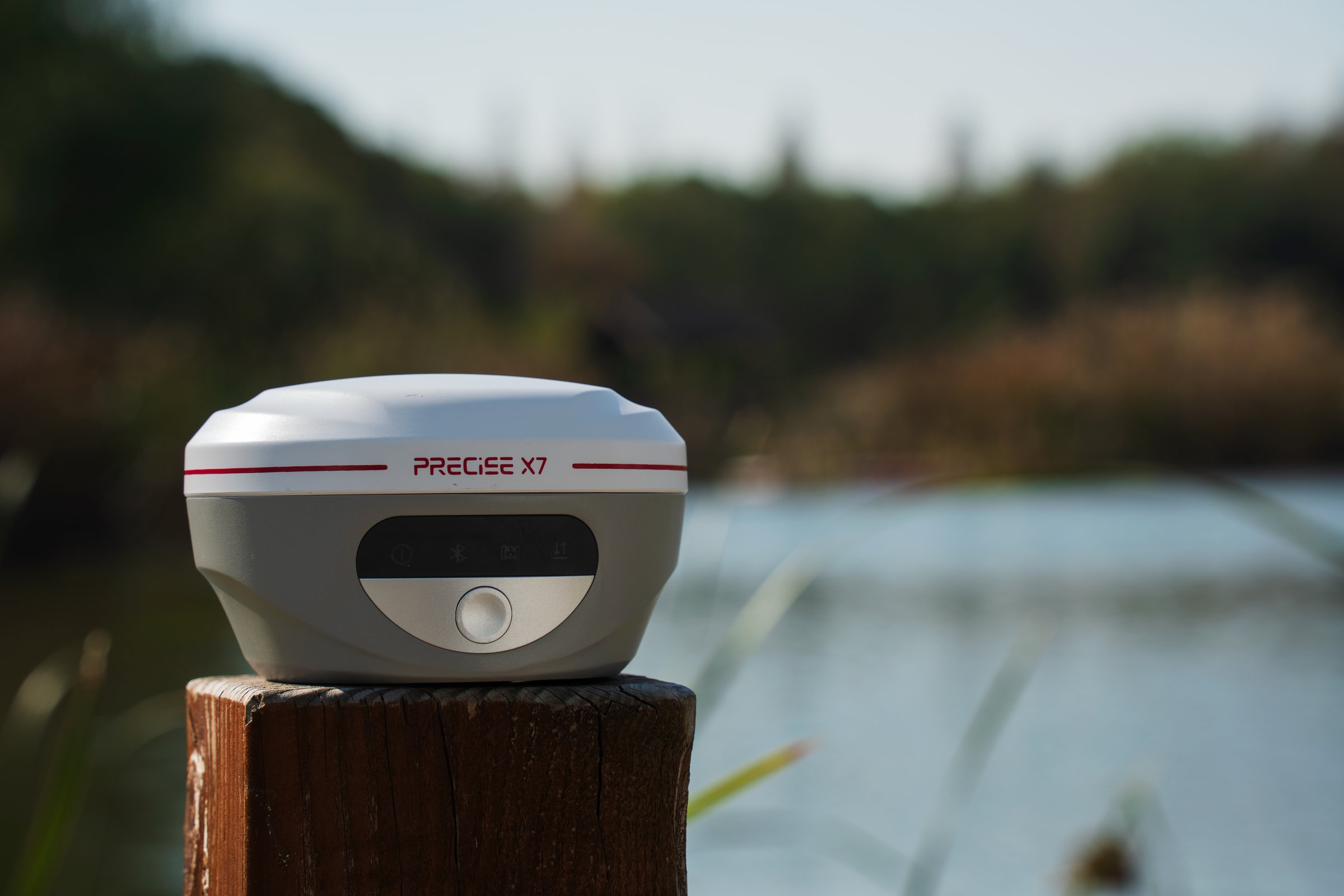
PRECISE X7: IMU tilt survey without leveling the pole
X7 uses its built-in IMU to measure pole tilt in real time and compute the pole-tip's true position without requiring the pole to be vertical, up to ±60° of tilt, with better than 2 cm accuracy within that range. The IMU needs no field calibration, resists magnetic interference from nearby structures or vehicles, and is ready within seconds of power-on, compensating continuously rather than requiring the operator to stop and re-level between points.
±60° tilt range · better than 2 cm accuracy within range
Explore PRECISE X7FAQ
Common Questions
GNSS gives you the antenna's position, not the orientation of what it's mounted to. See "GNSS Alone" above for why that gap matters. IMU sensing fills it in, so the system can calculate the true position of the pole tip, bucket edge, or implement instead of just the antenna.
No. IMU handles orientation and short-term motion tracking; the underlying position fix still depends on GNSS/RTK. On X7, for example, the IMU computes a tilt-corrected tip position relative to the RTK fix the receiver has already established; it doesn't substitute for that fix.
No. Unlike PRECISE's MLF-SLAM scanning technology, which is built to operate independently of GNSS, GNSS+IMU fusion still depends on satellite visibility for its position component.
They're solving different problems. E2 needs to track a multi-jointed machine (boom, arm, bucket) in real time, so it uses two GNSS receivers for position/heading and two IMU sensors distributed across the machine's moving parts. X7 is a handheld pole receiver solving a single problem (the tilt of one pole), so one IMU at the pole is enough to compute the tip position.
A Pro's attitude sensing corrects for tilt and roll on sloped or uneven ground, extending reliable path-holding to terrain that would otherwise cause an uncorrected system to drift. Performance still depends on the severity of the slope and overall field conditions; it's a compensation system, not a guarantee against every terrain extreme.
It depends on the product and isn't always separable into two numbers. E2 reports combined figures (±1.5 cm horizontal, ±3 cm elevation) that reflect the fused GNSS+IMU output, plus a separate IMU-specific figure (0.2° bucket dynamic attitude accuracy). X7 reports RTK accuracy (±8 mm + 1 ppm horizontal) and IMU tilt accuracy (under 2 cm within ±60° tilt) as related but distinct figures, since the IMU tilt calculation builds on top of the RTK-established position.
Need position and orientation together, not just a coordinate?
Tell us what you're trying to track: a machine's working attachment, a steering line across variable terrain, or a survey point you can't stand a pole up straight on, and a PRECISE engineer will point you to the right product configuration.